This data is provided from the logbook information in the MySSI app
Affiliated Training Center
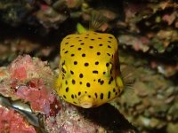
Dive sites nearby
© Aqualung
Komatsu
Learn more
© SSI Service Center Japan, 101-0051 Chiyoda-ku
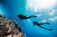
Kanmurishima Island
Learn more
© SSI Service Center Japan, 101-0051 Chiyoda-ku
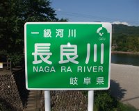
Nagaragawa River
Learn more
© BLUE PETER, 606-8395 Kyoto
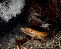
Kumogahata
Learn more
© SSI Service Center Japan, 101-0051 Chiyoda-ku
Namerikawa
Learn more
© SSI Service Center Japan, 101-0051 Chiyoda-ku
Tajiri
Learn more

© Mares
Notojima Island
Learn more
© MARINE SERVICE BUDDY, 939-0703 Shimoniikawa-gun
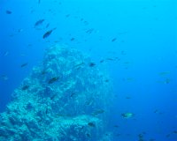
Okinose W Arch
Learn more
© Scubapro, Stephen Frink
Owase
Learn more
© takuya i. (#2528270)
Oyashirazu
Learn more
The dive spots and related content on MyDiveGuide are provided for informational and promotional purposes only. This information, including user-generated content, is not definitive advice or recommendations. Divers are fully responsible for planning their dives, ensuring adequate safety equipment, verifying diving permissions, and complying with local laws and regulations. SSI, MyDiveGuide, and affiliates assume no responsibility or liability for divers' actions, choices, or any incidents. Always dive within your training limits, prioritize safety, and confirm that diving is permitted at your chosen location.