© Shark Explorers, 7975 Simons Town
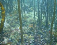
Windmill Beach
This site has a very easy and protected beach entry and a small cove with a sandy bottom that is suitable for training exercises, while also having a varied topography, diverse ecology, and large area.