Tsunami research: Reconstructing the lateral collapse of a volcano
environmentvolcanomarine researchtsunamigeophysics
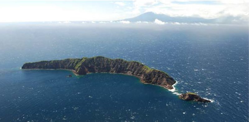
Aerial photo of Ritter Island.
(c) www.oceanicexpeditions.org
Flank collapses of volcanic islands produce massive landslides Volcanic eruptions can cause destructive tsunamis. As part of an
expedition, marine researchers, under the direction of the GEOMAR
Helmholtz Center for Ocean Research Kiel, are on an expedition to
investigate the break-up of Ritter Island in the West Pacific.
Flank collapses of volcanic islands produce massive landslides that can
lead to large tsunamis. Computer simulations show that very large
volcanic landslides may even lead to ocean floods. However, the
magnitude of such tsunamis is controversial because it depends on many
factors, in particular the submarine transport and deposition
processes. To get a comprehensive analysis of the amount of risk
resulting from flank collapses, it is essential to study these factors
in detail.
Over the next four weeks, a team of scientists will travel on board the
German research vessel SONNE, under the direction of geophysicist
Professor Dr Christian Berndt from GEOMAR. They will examine the
western flank of Ritter Island in the Bismark Sea. In 1888, about five
cubic kilometres of material were moved during the collapse of the
western flank of the island. The incident is the largest documented
lateral collapse of a volcano, " said Berndt.
According to the researchers, conditions in the area were ideal for the
reconstruction of submarine transport and deposit processes. This was
because the collapse had taken place recently (geologically speaking),
so the deposits are clearly recognisable. In addition, historical
records such as eyewitness reports have been handed down through the
generations. Among other things, the details include the tsunami's
height and time of occurrence, as observed and documented by German
settlers on neighbouring islands.
We will use a series of different geological, geophysical and
biological approaches to learn more about the event, " said Berndt.
After a detailed mapping with multibeam echosounder and parasound is
completed, seismic methods would be used. Using the "P-Cable System" of
GEOMAR, a three-dimensional image of the underground would be created
to analyse the dynamics of the volcanic landslide. Sediment samples
would be taken from the remnants to determine their composition and
origin as well as the temporal development. GEOMAR's HyBIS deep-sea
robot would then be used to retrieve samples of large chute blocks and
map the structures on the seabed through video capture.
With the help of the data obtained, it will be possible to simulate
the tsunami and collapse so as to calculate unknown parameters like the
acceleration and velocity of the collapsed material, which can then be
used in the hazard analysis of other volcanoes, " said Berndt.
See here for further information
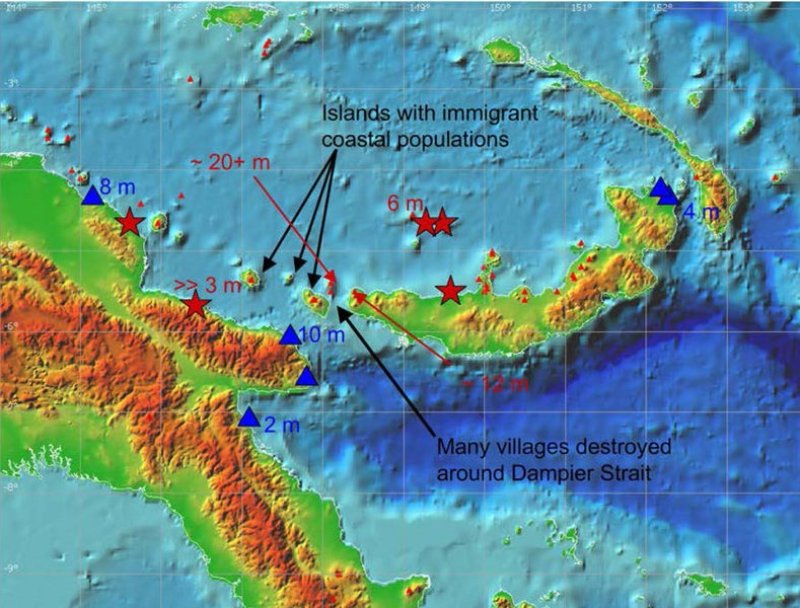
The work area of the expedition. The red stars are the villages that were destroyed by the Knights Island tsunami. The blue triangles show the places from which the tsunami was observed by German colonies.
(c) GEOMAR
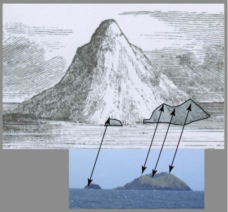
Knights Island before and after the collapse in 1888: The arrows in the photo from 2004 indicate the outlines that can be attributed to the illustration of 1835.
(c) Jacobs, 1844
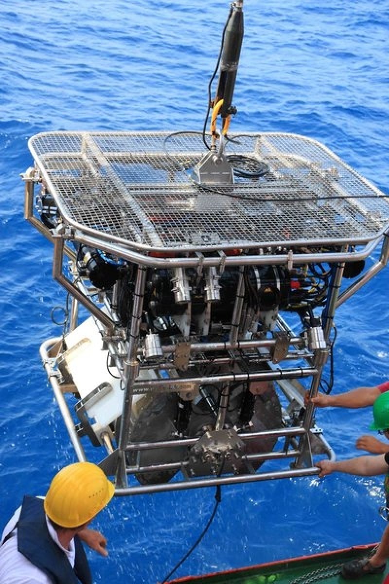
HyBis is a multi-purpose robotic underwater vehicle (RUV), which is controlled by a fiber optical cable and is equipped with a sampling grab.
(c) GEOMAR
Cet article a été traduit automatiquement et peut contenir des inexactitudes mineures ; veuillez vous référer à la version anglaise originale en cas de doute.