Researchers are reconstructing the history of the sea level
environmentclimate changeocean researchsea level risefossil coral reefs
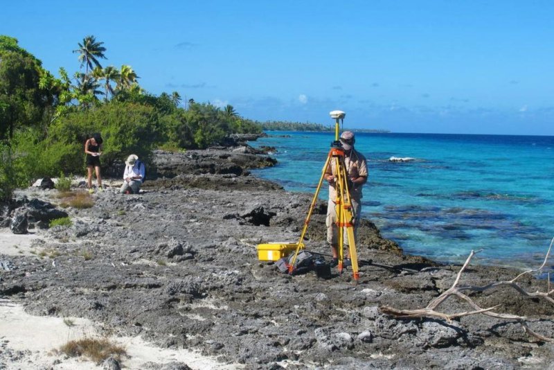
To reconstruct sea level changes in the Central Pacific Ocean, researchers have measured and sampled miniature-atolls in French Polynesia. The fossil coral was dated at GEOMAR in Kiel (c) Anton Eisenhauer / GEOMAR
Fossil coral reefs as a key to 6000 years of development The sea level rises according to current forecasts between 80 and 180 centimetres by the end of the century. For a detailed impact assessment, it is important to know how sea levels have behaved in recent geological history. In a new study, an international research team has now published for the first time a centimetre-accurate sea level reconstruction in the central Pacific over the past 6,000 years. The currently globally rising sea level is a direct consequence of climate change. According to current calculations, melting glaciers and the warming of the ocean waters ensure that by the end of this century the ocean level will be 80 to 180 centimetres higher. But these figures only reflect regional developments. If you want to know how the volume of seawater changes exactly, you need more detailed information about sea-level dynamics over long periods of time. A look into the past can help. Because in previous millennia, the sea level was rarely constant, the permanent change, however, was the rule. In the international journal Nature Communications, a group of researchers from France, Switzerland, Canada and the GEOMAR Helmholtz Center for Ocean Research Kiel has now published a centimetre-accurate history of sea level in the central Pacific over the past 6,000 years. For their study, the researchers studied micro-atolls on twelve South Pacific islands, which are formed by special stony corals of the genus Porites in the period from 2012 to 2015. These miniature atolls have diameters between ten centimetres and eight meters. "Fossil coral reefs have long been used as witnesses of earlier water levels because they only grow relatively close to the water surface. But the accuracy is limited because the growth range is usually between 0 and 20 meters under water, "explains Prof. Dr. med. Anton Eisenhauer from GEOMAR, one of the co-authors of the study. The corals of the genus Porites, however, grow directly to the water surface and then horizontally on the border between water and air on. "The fact that we used it as a sea level indicator for the first time was decisive for the precise statement about the height of the sea level in the past," explains Eisenhauer. However, the fossil, today partly above the waterline, also had to be dated exactly. The researchers were able to determine the age of the samples to a few tens of years or even years. For this they use the so-called uranium-thorium method, which is based on the fact that proportions of the elements uranium and thorium in the samples are compared with the proportions at the time of the formation of the coral. The analysis of the data shows that the sea level in French Polynesia between 6000 and 4000 years before today has risen steadily until it reached a maximum value about one meter above its current level. Since then, the sea level has dropped again, the reason for the existence of the tropical island world with numerous coral atolls in the Pacific and Indian Ocean. Rising and falling reflect the melting of the ice caps and the dynamics of the Antarctic ice pack. The actual dynamics of the ocean volume since the last sea level rise can be calculated by complex mathematical calculations from the obtained sea level curve. The data show that even after the climatic peak and the maximum solar radiation 6000 years ago, the sea level rose by a further 1.5 to 2.5 meters at a rate between 0.3 and 0.5 millimetres per year. "This extra contribution from meltwater inputs is believed to come from melting pack ice from the Antarctic. The results also show that over the last 6,000 years, sea levels have remained stable within narrow limits for only a maximum of 300 years, but otherwise have a high level of dynamics, "said Professor Eisenhauer. This knowledge will also feed into future estimates for the level of expected sea level. "The current, man-made increase, however, differs in one factor from the earth-historical events: it is much faster," emphasizes Professor Eisenhauer. Link to the study https://www.nature.com/articles/s41467-017-02695-7
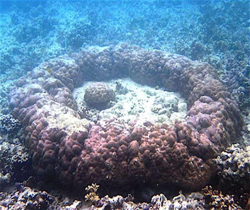
Miniature Atoll (c) R. van Woesik, Y. Golbuu and G. Roff / Wikimedia
この記事は自動翻訳されており、多少の不正確な点が含まれている可能性があります。不明な点がある場合は、元の英語版を参照してください。