New online maps predict location of blue whale hotspots
environmentmarine lifeoceanconservationblue whales
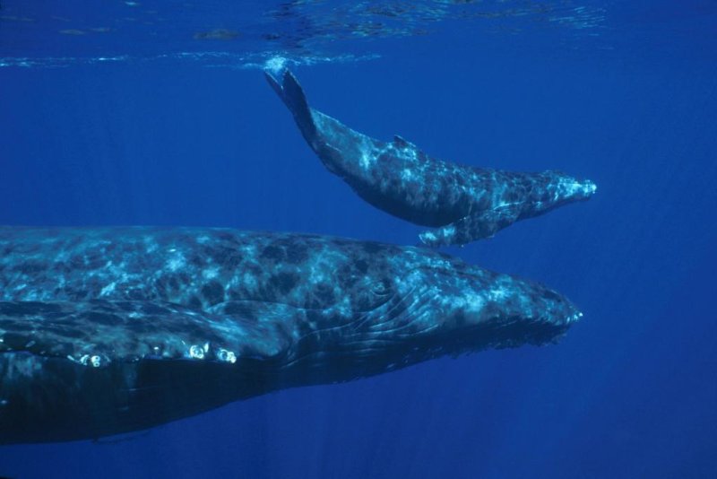
A humpback whale and its calf in NOAA's Hawaiian Islands Humpback Whale National Marine Sanctuary. (c) von NOAA
Tool aimed at helping ships avoid collisions with blue whales Researchers from NOAA Fisheries, Oregon State University and the
University of Maryland have teamed up to make the waters off America's
West Coast safer for blue whales, by posting online maps every month
showing blue whale hotspots to alert ships to areas where there may be
an increased risk of encountering the whales. The maps were developed by combining the tracking data of tagged whales
with satellite observations of ocean conditions. A paper in a recent
edition of Journal of Applied Ecology describes the development of the
programme – called WhaleWatch - and the methodology behind it.
L ead author Elliott Hazen, a research ecologist at NOAA Fisheries
Southwest Fisheries Science Center said, " We're using the many years of
tag data to let the whales tell us where they go, and under what
conditions. If we know what drives their hotspots, we can more clearly
assess different management options to reduce risk to the whales, "
Describing WhaleWatch as an innovative combination of satellite
technology and computer modelling, co-author Helen Bailey, the
WhaleWatch project leader at the University of Maryland Center for
Environmental Science, said that " this is the first time that we've
been able to predict whale densities on a year-round basis in near-real
time. We hope it's going to protect the whales by helping inform the
shipping industry. "
In addition, she hopes that the programme can be extended to other whale
species. Oregon State University's Bruce Mate and his team were the
ones
responsible for the tracking data of more than 100 blue whales from
1994 to 2008, which now forms the backbone of WhaleWatch. He said,
" These aren't guesstimates of how whales may respond to certain
conditions, but actual data on how they did respond, which improves the
accuracy of the predictions. Earlier research has found that shipping lanes to and from Los Angeles
and San Francisco overlap with major blue whale foraging hotspots,
putting the whales at risk of fatal ship strikes. In fact, studies have
shown that ships off the West Coast strike an average of two blue
whales every year, although some ship strikes probably go unnoticed.
No ship captain or shipping company wants to strike a whale," said Kip
Louttit, executive director of the Marine Exchange of Southern
California, which tracks ship traffic into and out of Southern
California ports. "If we can provide good scientific information about
the areas that should be avoided, areas the whales are using, I think
the industry is going to take that very seriously and put it to use.

(c) John Calambokidis, Cascadia Research NOAA
この記事は自動翻訳されており、多少の不正確な点が含まれている可能性があります。不明な点がある場合は、元の英語版を参照してください。